The University of Waterloo is empowering national park visitors to get directly involved with scientific research into glacier regression.
As part of a new citizen science program launched in collaboration with Parks Canada, the Icy Initiative uses photos taken by visitors to monitor glacier regression in both Jasper National Park and Glacier National Park.
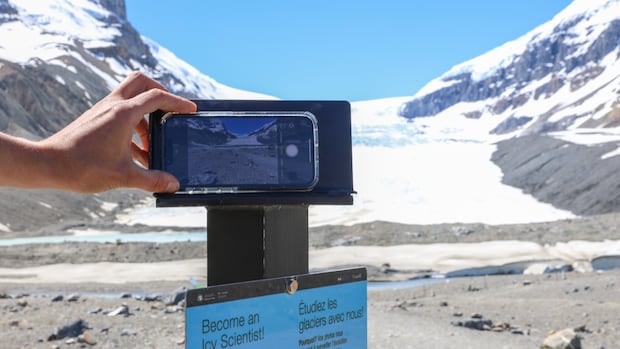
Chris Houser is the dean of science and a professor of earth and environmental sciences at the University of Waterloo. Cellphone stands designed by Houser and his research team have been installed at select glacier viewpoints.
In a process called repeat photography, visitors use the stands to take photos from the exact same location, allowing researchers to track gradual changes in the glaciers over time.
Historically, environmental research has been conducted by researchers themselves, using the same technique they are now using in the Icy Initiative. Houser noted doing the research that way means the public doesn’t get to see the data or be a part of the research process.
He said that by having citizens take the photos themselves, it allows them to see that “these landscapes are in fact changing,” and also how quickly.
At each checkpoint, visitors can place their phones in the stands and then use a QR code on the side of the stands to submit their photos. After submission, the photos can be accessed by researchers, citizen science groups and the general public. This allows for easier transmission of information, Houser said.
Because the project is so new, none of the images collected so far will be “mind-blowing,” he said.
“But given time, given the ability to then reconcile these against historical photos, we start to gain that information.”
Houser added that the point of the project is not the data itself, but encouraging people to think about the environment and how it’s rapidly changing.
“Our landscape is vast, not just even within Alberta and British Columbia. It is vast across Canada,” he said. “It’s diverse.
“We can’t be everywhere all at once. By having these stands, we’re getting more people to see what is happening, to help us record that data and to begin to build that science even further.”
Kim Weir, a product development specialist in Jasper National Park, said there was almost immediate interest shown toward the Icy Initiative, even before installation was complete.
She said although the collected data is a major benefit for researchers, allowing visitors to connect to the landscape is key to the program’s success.
“We have thousands and thousands of visitors that come to the Columbia Icefield area and view the Athabasca Glacier,” Weir said.
“I dare say pretty much every one of them leaves with a sense of awe and grandeur of glaciers and glaciated landscapes.”
Weir said the “awe of these places” is what drives the success of citizen science initiatives like the Icy Initiative and earlier projects, like Coastie, also led by Houser in collaboration with Parks Canada.
That project saw phone stands set up across Atlantic Canada, with photographs taken by civilians allowing researchers to monitor coastal changes.
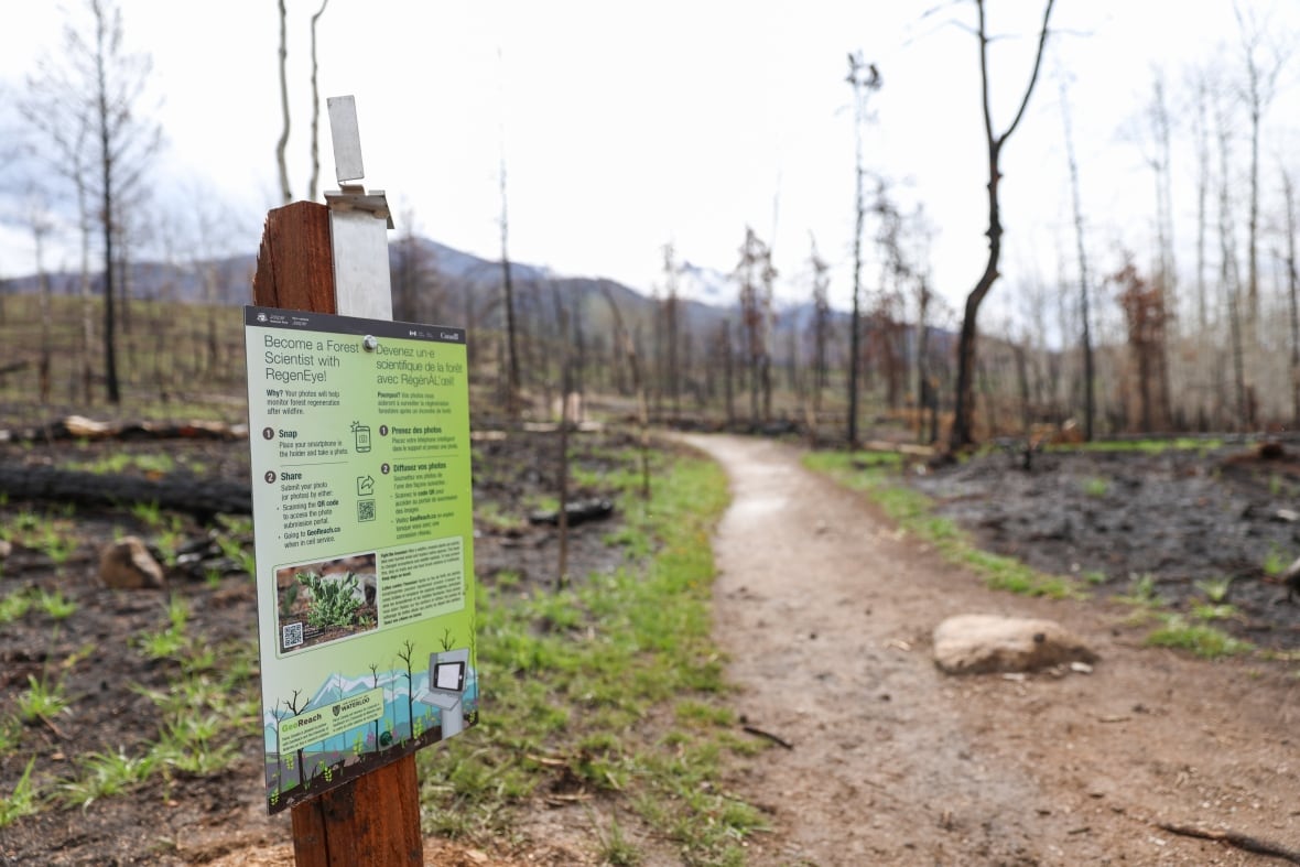
A similar approach will be applied to learn more about tree regeneration in Jasper National Park in the aftermath of the 2024 wildfires. As a part of RegenEye, visitors walking along the Old Fort Point Trail can help researchers track tree growth.
Weir hopes that by gathering the photos themselves, visitors will develop a stronger connection to the landscape.
“When they become part of gathering the data, the hope is that they are not only left with beautiful photos, but maybe start thinking about how important our glaciers are.”
